Industry Engagement Activity (IdEA): National Highways

National Highways inspection engineers have to negotiate slippery slopes at the side of busy motorways and get up close to structures like signage gantries. So, to make their jobs safer, the organisation is examining ways in which robots can help.
CRADLE’s first Industry Engagement Activity (IdEA) was organised for National Highways, a government-owned company responsible for operating, maintaining, and improving England’s major roads. Prior engagements with Jacobs raised initial discussions on how highway inspection could be carried out more safely by using robotics and remote operations to reduce the amount of time people spend on the road in hazardous conditions.
Read more: CRADLE Industry Day: National Highways
On the 20th of September 2023, an ‘Industry Day’ workshop was attended by representatives from Jacobs, The University of Manchester, and National Highways. The team spent the morning discussing the breadth of challenges facing National Highways, then used the afternoon to prioritise these challenges according to urgency and impact. As a result of the workshop, the CRADLE team presented several technology implementations to demonstrate robotics capabilities for the sector.
Initial Visit to M61 Motorway
With the guidance of a National Highways inspection engineer, the CRADLE team initially visited a verge in a section of the M61 motorway that had landslips and other hazards. The purpose of the visit was to determine and demonstrate the suitability of robotic sensors (LiDAR, RGBD depth sensor, stereo cameras, etc.) for these inspections.
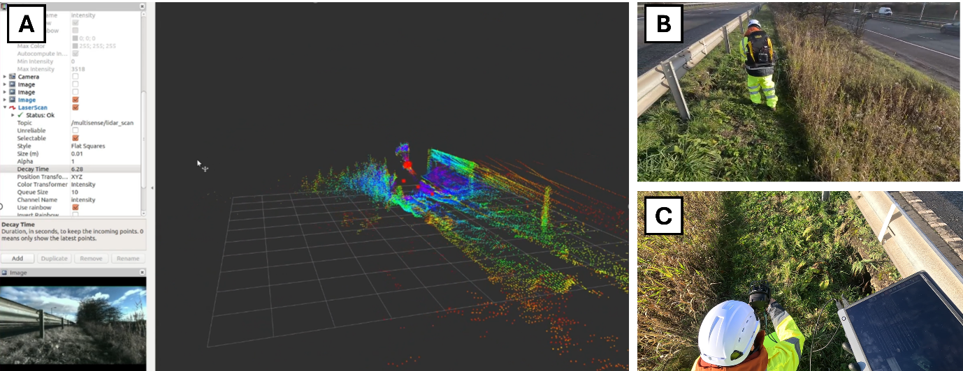
Initial visit to a section of the M61 motorway as part of the National Highways industry engagement. (A) Point cloud data generated from a LiDAR and stereo-camera sensor kit. (B-C) Photos taken at the verge of the motorway. (C) Vegetation and subsidence as prominent features to be noted and reported by the inspection engineer.
Technical Sprint and Deployment at the National Highways Development Centre
National Highways’ two key challenges relate to the frequent human inspection of motorway edges and how to inspect the interior of structures such as motorway gantries. In February 2024, the CRADLE team held a two-week technical sprint aimed at demonstrating the CRADLE team’s robotic capabilities that could lead to further collaboration with the sector via new research opportunities (e.g., sponsored work, and PhD projects). This industry engagement concluded with a deployment at the National Highways Development Centre test motorway at the Fire Service College near the Cotswolds on the 13th of March 2024.
The deployment involved several robotic platforms that gathered footage and geospatial data of simulated features characterised during the initial visit:
- Unmanned ground vehicle (UGV) with sensors (i.e., a ClearPath Jackal with a GNSS receiver, Ouster LiDAR, and RealSense camera)
- Boston Dynamics Spot quadruped with a Leica 360 LiDAR
- Unmanned aerial vehicle (UAV) with LiDAR, GNSS receiver, and cameras
- GeoPod sensor payload on aircraft
The figures below show the platforms deployed on-site and their corresponding data.
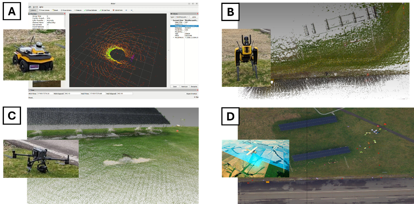
CRADLE’s deployment activity at the National Highways Development Centre. (A) ClearPath UGV with a LiDAR sensor, depth camera, and GNSS receiver. (B) Boston Dynamics Spot with a Leica 360 LiDAR sensor. (C) Matrice 300 UAV with LiDAR sensors, GNSS receiver, and onboard cameras. (D) GeoPod sensor payload on an aircraft.
This first engagement was a positive success, and many interesting ideas and lessons were learned for the CRADLE team. Check out our video below.